KRABI
KRABI
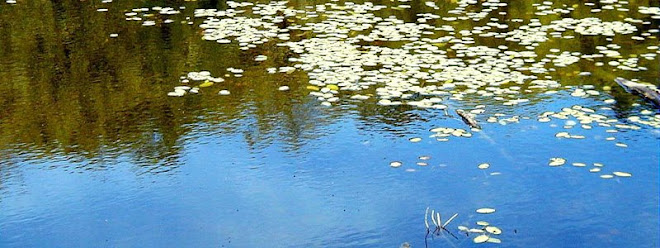
Located approximately 814 kilometers from Bangkok is Krabi Province, one of most attractive destinations in southern Thailand. Encompassing an area of 4,708 square kilometers, the western border of Krabi is the Andaman Sea, the northern borders are Surat Thani and Phang-nga Provinces, the southern borders are Trang Province and the Andaman Sea and the eastern borders are Nakhon Si Thammarat and Trang Provinces. Krabi is an ideal getaway destination teeming with natural attractions including white sandy beaches, fascinating coral reefs, numerous large and small islands and verdant forests with caves and waterfalls.
Krabi's topography is mostly mountains and highlands separated by plains in some parts. Flowing through Krabi City to the Andaman Sea at Pak Nam Sub-district is Maenam Krabi which is 5 kilometers in length. In addition, there are several canals originating from the province's highest mountain range, Khao Phanom Bencha including Khlong Pakasai, Khlong Krabi Yai and Khlong Krabi Noi. Lush mangrove forests line the canals and the banks of Maenam Krabi particularly before it empties into the Andaman Sea. The provinces sandy soil conditions are suitable for growing various agricultural products, particularly rubber trees, palms, coconuts, cashew nuts and coffee.
 Due to the influence of the tropical monsoon, there are only two seasons in Krabi; the hot season from January to April and the rainy season from May to December. Temperatures range between 17 C and 37 C.
Krabi is administratively divided into 8 Amphoes (Districts): Amphoe Mueang, Khao Phanom, Khlong Thom, Plai Phraya, Ko Lanta, Ao Luek, Lam Thap, and Nuea Khlong. The provinces jurisdiction covers not only in-land districts and sub-districts, but also extends to more than 130 large and small islands including the world famous Phi Phi Islands.
In addition, Krabi is the location of two world class beaches Ao Nang and Hat Rai Le which offer numerous diving trips, restaurants, shops etc. Additional attractions in the province are stunning limestone cliffs and rock formations which make it a heaven for rock climbers and a National Park located approximately 40 kilometers outside of town with lakes, caves and spectacular natural scenery.
History of Krabi
Some archeologists claim that Krabi City is one of the older settlements in the country as there is archaeological evidence indicating that this area had been home to homosapiens during the prehistoric times or between 25,000 - 35,000 B. C. The assumption has been strongly supported by the discovery of stone tools, ancient colored pictures, beads, pottery and skeletal remains in the provinces cliffs and caves.
In 1200 A.D., the area was known as Ban Thai Samo, one of 12 royal cities that had a monkey as the town symbol. During this period of time, Krabi was under the rule of the Kingdom of Ligor, a city better known today as Nakhon Si Thammarat.
During the reign of King Rama V (1868-1910), the community was known as Pakasai Sub-county and remained under the direct jurisdiction of Nakhon Si Thammarat province.
Around 1872, King Rama V elevated Pakasai Sub-county to Krabi Province with the provincial administration office situated at Krabi-yai Sub-county (currently, the office is located near the estuary at Pak Nam Sub-district) and in 1875, ordered the separation of Krabi Province from Nakhon Si Thammarat Province.
During the present reign, the corps of civil servants, merchants, and the people of Krabi and nearby provinces have collectively organized the construction of a royal residence at Laem Hang Nak Cape which is thirty kilometers west of Krabi Town on the Andaman coast to be presented to His Majesty the King.
Origin of the name Krabi
 There are two legends concerning the origin of the name "Krabi". The first is that villagers presented a large ancient sword (or krabi) that was discovered by chance to the governor. Later when a smaller, on discovering a smaller one, it was also presented to the governor. Regarded as sacred and auspicious, the governor decided to keep them in the province. As the process for the establishment of the province was still in progress, the swords were placed crossing each other in Khao Khanap Nam cave. Since then, the crossed swords have remained a part of the provincial seal.
The second legend is that "Krabi" was derived from the name of a local tree known as "Lumphi". The Malay and Chinese merchants mispronunciation of the name to "Ka-lu-bi" or "Kho-lo-bi" finally resulted in "Krabi" (or sword).
Distances from Amphoe Mueang (Town) to Neighboring Districts
Ao Luek 43 kms.
Plai Phraya 66 kms.
Khao Phanom 39 kms.
Khlong Thom 42 kms.
Ko Lanta 103 kms.
Lam Thap 67 kms.
Nuea Khlong17 kms.
http://www.tourismthailand.org/
 YALA
YALA
 Trang has geographical advantages similar to that of Krabi and Phang-Nga. This includes breathtaking islands and astounding beaches along the coast as well as awe-inspiring inland limestone- propped mountains. The province consists of an archipelago in the Andaman Sea with over 46 islands. Of these, 12 are in Amphoe Kantang, 13 in Amphoe Palian and 21 in Amphoe Sikao. The best time to visit Trang is between December and May.
 With an abundance of blissful attractions mixed with cultural heritage, Trang Province is truly an emerging fascinating tourist destination with numerous jungles, mountains and waterfalls.


 High plateaus and forested mountains are located to the west of the province, while there are low basins in the center and along the eastern coast. This topography has created 14 river basins including Tapee, Pum Duang, Tha Thong, Tha Krajai, Chaiya, Tha Chang which are the most important basins. All rivers in Surat Thani flow east of the province to the Gulf of Thailand.
 The numerous islands along the coast makes Surat Thani (often known as Surat in short) a perfect hideaway for vacationers from around the world. The ideal destination for many is the Penang-sized Ko Samui, Thailand's third largest island, and its neighbour Ko Pha-ngan a celebrated island that hosts the biggest beach full moon party. North of Ko Pha-ngan is Ko Tao, renowned for its excellent coral reefs. To top it all is the dazzling 250-square-kilometer Ang Thong Marine National Park, where a stunning archipelago awaits to greet visitors with their charming palm-fringed beaches, crystal clear water and colorful coral reefs. The best time to enjoy one of these islands to the fullest is from April to November.
 Surat Thani is a city with a long history. Archeologists believe that it was once a community of prehistoric tribes of indigenous people including the Saemang and original Malays who built their communities on the Tapee River Basin and Ao Ban Don. Later on, the Indians migrated into the area and gradually spread out their culture, as evidenced in the discovery of ruins of ancient communities in Tha Chana and Chaiya Sub-districts.
 In the 13th century, the city became a part of and, as some historians might claim, a center of the glorious Srivijaya Empire the kingdom that dominated the whole Malay Peninsula and much of Java. It was during this period that Mahayana Buddhist reached its height of influence. The empires grandeur can still be admired in many areas of Chaiya District.
 When the empire hit the bottom, it was divided into 3 main cities namely Chaiya, Tha Thong and Khiri Rat. They were all under the jurisdiction of Nakhon Si Thammarat until King Rama IV decided to move Tha Thong City to Ban Don and required that it report directly to Bangkoks administration. The name Ban Don was, at the time, changed to Kanchanadit. It was with the establishment of the Monthon, a former administrative unit, that all three cities were merged into one under the name Chaiya. In 1915, King Rama VI changed the name Chaiya to Surat Thani.
 The seal of Surat Thani says a lot about its history. Featuring the pagoda of Phra Boromathat Chaiya, the seal is proof of the influence of Mahayana Buddhist on Surat Thani. Phra Boromathat Chaiya is the most revered and important historical place in the province. It is believed that the pagoda contains Buddha relics.
 Today, Surat Thani is an important commercial and shipping hub for rubber and coconut trading.
 Songkhla, a medieval pirate stronghold, is a historic, albeit sleepy town with a thriving fishing community. Another Srivijaya outpost in Thailands southern region, Songkhla was initially named Sa-thing". Previously a port and a coastal trading post where Indian, Persian and Arabian merchants came to exchange their products, the place was named "Sing Lha" after the 2 lion-shape islands at the mouth of the city's lake. At present, these 2 islands are Koh Nu (Rat Island) and Koh Maeo (Cat Island). The old part of Songkhla is located at the present-day Amphoe Sathing Phra.
 Over the last few decades, Songkhla has been rapidly developed and is currently a unique attraction worth visiting. Blessed with natural resources such as fine beaches, enchanting waterfalls, and a tranquil lake, the province has an abundance of tourist attractions and an amazing range of seaside resort towns. Moreover, the old section of Songkhla still maintains its unique identity of ancient and historical flavors through local architecture and cuisine.

 A mountainous and heavily forested province, Ranong is best known as a fishing and trading port. It was settled by the Hokkian Chinese, and their strong influence is evident in the town. Ranong town is a gateway to Myanmar, with colourful longboats ferrying produce and people across the narrow divide that separates the two countries. The traffic is even heavier these days since a casino opened at Victoria Point. The famous hot springs are just outside of town, where an arboretum and various first-class hotels cater to visitors eager to benefit from the medicinal properties of the mineral waters.
 Nestled in the tropical zone off the west coast of the southern part of Thailand in the Andaman Sea and the Indian Ocean, the province covers an area of approximately 543 square kilometers (excluding small islets). It is estimated that Phuket Province covers an area of approximately 590 square kilometers if its 39 other small islands are included. The islands total length, from north to south, is estimated at 48.7 kilometers and approximately 21.3 kilometers wide.
 Staying on the island is easy, as there are only two seasons in a year - the rainy season (May to October) and the hot season (November to April). The low season of phuket is between September and October as they are the wettest months. The best period for a visit, is from November to February, when it is possible to see the clear blue sky, feel the fresh sea breeze and marvel at the crystal clear water while lying on powdery, palm-fringed beaches. Average temperatures ranges between 23 C and 33 C.
 Phuket has a lot more to offer its visitors other than its natural heritage sea, sand, sky, beach, forest, and world renowned diving sites. Sino-Portuguese architecture casts its spell delighting travelers to the city, while Phuket-style hospitality has never failed to impress visitors from all walks of life. In addition, accommodations ranging from world-class resorts to tropical-style bungalows have warmly catered to the different needs of travelers. For seafood lovers, there is a lot more to sample than just Phuket's famous lobster. Altogether, these characteristics have made Phuket a truly unique destination.
 Thalang town was surrounded by Burmese troops who invaded the coastal area in 1785. It was under the leadership of Chan, the widow of the governor, and her sister, Muk, who united local residents and successfully fought and drove the invaders out of Phuket. It took over 30 days for the defending troops of Phuket, under the command of Chan and Muk, to claim their victory. As a result of such heroic deeds, noble titles were granted to Chan and Muk as Thao Thep Krasattri and Thao Si Sunthon respectively. To honor them, a monument was established at Tha Ruea Intersection, 12 kilometers to the north of Phuket City in 1966. They are still highly respected by Phuket residents even today.
 The tin mining industry has gradually failed to generate economic growth in Phuket, especially after 1985 when the price of tin fell by half. However, with its natural resources, Phuket later emerged as a tourist destination with great potential. This polished pearl of the Andaman is truly a destination that provides visitors with memorable experiences.
 Phatthalung city is situated on the west bank of Songkhla Lake, about 846 kilometres from Bangkok. It has an area of 3,424.473 square kilometres and is divided into 10 districts and 1 sub-district, as follows: Mueang Phatthalung, Khuan Khanun, Pak Phayun, Kong Ra, Tamot, Khao Chaison, Pa Bon, Bang Kaeo, Si Banphot, Pa Phayom, and the sub-district of Srinagarindra.
 Phang-nga's andaman coast offers parks of a different kind. The island groups of Surin and Similan are renowned for their beautiful unspoilt beaches and spectacular underwater scenery, attracting divers from around the world. Khao Lak is a coastal park full of birds, mammals and scenic waterfalls, with a number of hotel developments after Tsunami disaster in December 2004.
 With an area of 4,475 square kilometers, of which 75 percent are jungles and mountains, visitors to the province are provided with great opportunities to spend days at the beach or in the forests and take excursion trips to some of the magnificent temples. Narathiwat has a tropical climate and has only 2 seasons; summer and rainy. The wettest period is during November to December.